


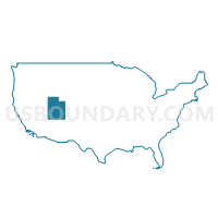
Salt Lake County--West Valley City (East), Taylorsville & Murray (West) Cities PUMA, Utah
About
Outline
%2c+Taylorsville+%26+Murray+(West)+Cities+PUMA%2c+Utah_A280.png)
Summary
| Unique Area Identifier | 194253 |
| Name | Salt Lake County--West Valley City (East), Taylorsville & Murray (West) Cities PUMA |
| State | Utah |
| Area (square miles) | 30.19 |
| Land Area (square miles) | 30.14 |
| Water Area (square miles) | 0.05 |
| % of Land Area | 99.83 |
| % of Water Area | 0.17 |
| Latitude of the Internal Point | 40.68587820 |
| Longtitude of the Internal Point | -111.92786200 |
Maps
%2c+Taylorsville+%26+Murray+(West)+Cities+PUMA in Utah.png)
Graphs
Select a template below for downloading or customizing gragh for Salt Lake County--West Valley City (East), Taylorsville & Murray (West) Cities PUMA, Utah
%2c+Taylorsville+%26+Murray+(West)+Cities+PUMA%2c+Utah_T0.png)
%2c+Taylorsville+%26+Murray+(West)+Cities+PUMA%2c+Utah_T1.png)
%2c+Taylorsville+%26+Murray+(West)+Cities+PUMA%2c+Utah_T2.png)
%2c+Taylorsville+%26+Murray+(West)+Cities+PUMA%2c+Utah_T3.png)
%2c+Taylorsville+%26+Murray+(West)+Cities+PUMA%2c+Utah_T4.png)
%2c+Taylorsville+%26+Murray+(West)+Cities+PUMA%2c+Utah_T5.png)
%2c+Taylorsville+%26+Murray+(West)+Cities+PUMA%2c+Utah_T6.png)
%2c+Taylorsville+%26+Murray+(West)+Cities+PUMA%2c+Utah_T7.png)
%2c+Taylorsville+%26+Murray+(West)+Cities+PUMA%2c+Utah.png)
Neighbors
Neighoring Public Use Microdata Area (by Name) Neighboring Public Use Microdata Area on the Map
- Salt Lake County (East Central)--Murray (East), Holladay Cities & Millcreek PUMA, UT
- Salt Lake County (Northeast)--Salt Lake City (East) PUMA, UT
- Salt Lake County (Northwest)--Salt Lake City (West), West Valley City (West) & Magna PUMA, UT
- Salt Lake County (Southeast)--Sandy (North), Cottonwood Heights & Midvale Cities PUMA, UT
- Salt Lake County--West Jordan (East), South Jordan (East) & Riverton Cities PUMA, UT
- Salt Lake County--West Valley City (Central), Salt Lake City (South Central) & Kearns PUMA, UT
Top 10 Neighboring County (by Population) Neighboring County on the Map
Top 10 Neighboring County Subdivision (by Population) Neighboring County Subdivision on the Map
Top 10 Neighboring Place (by Population) Neighboring Place on the Map
- Salt Lake City city, UT (186,440)
- West Valley City city, UT (129,480)
- West Jordan city, UT (103,712)
- Millcreek CDP, UT (62,139)
- Taylorsville city, UT (58,652)
- Murray city, UT (46,746)
- Midvale city, UT (27,964)
- South Salt Lake city, UT (23,617)
Top 10 Neighboring Unified School District (by Population) Neighboring Unified School District on the Map
- Granite School District, UT (385,194)
- Jordan School District, UT (218,793)
- Canyons School District, UT (204,224)
- Salt Lake City School District, UT (186,440)
- Murray School District, UT (35,004)
Top 10 Neighboring State Legislative District Lower Chamber (by Population) Neighboring State Legislative District Lower Chamber on the Map
- State House District 29, UT (36,489)
- State House District 33, UT (33,619)
- State House District 26, UT (33,477)
- State House District 35, UT (32,134)
- State House District 31, UT (31,667)
- State House District 44, UT (30,598)
- State House District 43, UT (30,573)
- State House District 34, UT (30,269)
- State House District 39, UT (29,830)
- State House District 30, UT (29,672)
Top 10 Neighboring State Legislative District Upper Chamber (by Population) Neighboring State Legislative District Upper Chamber on the Map
- State Senate District 12, UT (103,070)
- State Senate District 6, UT (94,697)
- State Senate District 1, UT (87,412)
- State Senate District 3, UT (84,154)
- State Senate District 2, UT (82,957)
- State Senate District 5, UT (79,775)
- State Senate District 4, UT (76,928)
- State Senate District 8, UT (74,996)
Top 10 Neighboring 111th Congressional District (by Population) Neighboring 111th Congressional District on the Map
- Congressional District 3, UT (966,232)
- Congressional District 1, UT (906,660)
- Congressional District 2, UT (890,993)
Top 10 Neighboring Census Tract (by Population) Neighboring Census Tract on the Map
- Census Tract 1133.05, Salt Lake County, UT (7,665)
- Census Tract 1116, Salt Lake County, UT (7,472)
- Census Tract 1121, Salt Lake County, UT (7,264)
- Census Tract 1133.07, Salt Lake County, UT (6,979)
- Census Tract 1134.06, Salt Lake County, UT (6,746)
- Census Tract 1129.04, Salt Lake County, UT (6,731)
- Census Tract 1114, Salt Lake County, UT (6,555)
- Census Tract 1135.21, Salt Lake County, UT (6,489)
- Census Tract 1135.09, Salt Lake County, UT (6,332)
- Census Tract 1129.14, Salt Lake County, UT (6,293)
Top 10 Neighboring 5-Digit ZIP Code Tabulation Area (by Population) Neighboring 5-Digit ZIP Code Tabulation Area on the Map
- 84118, UT (68,295)
- 84119, UT (53,077)
- 84120, UT (48,956)
- 84123, UT (37,900)
- 84084, UT (37,247)
- 84107, UT (30,863)
- 84047, UT (28,936)
- 84104, UT (24,869)
- 84115, UT (24,668)
- 84101, UT (5,277)